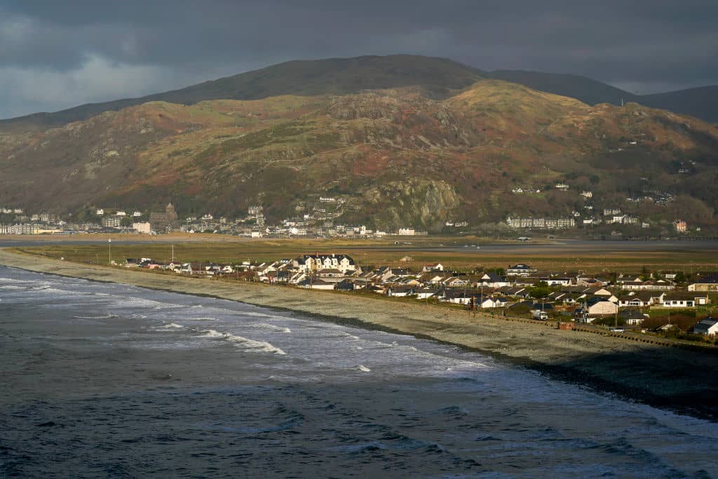
On the Welsh coast, surrounded by Snowdonia, the village of Fairbourne sits on a low, flat stretch of land. With sea on one side and mountain on the other, it seems perfectly situated. It is also doomed. Defended by high banks, the village is already substantially beneath sea level during storm tides. As sea levels rise, the government has decided to abandon it to the waves. Funding for sea defences is set to end by 2054.
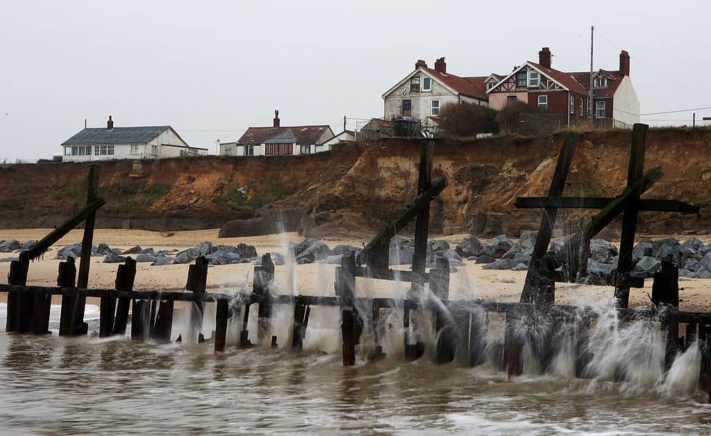
Fairbourne is far from the only community to face this fate. Over the next 28 years, some 200,000 buildings in Britain are set to end up below sea level. In some places, sea walls and embankments will hold the line. In others, nature will be left to take its course. People have been living in Happisburgh, Norfolk, for a very long time. The village church is grade 1 listed, the pub dates back to the 16th century, and in 2013 archaeologists examining a site exposed by coastal erosion found footprints dating back 850,000-950,000 years – the earliest found outside of Africa.
The same erosion that exposed these footprints destroyed them shortly after. Happisburgh is falling into the sea. The cliffs which hold the town lose three metres a year, crumbling away into the water below, taking with them houses, roads, and – eventually – the village entire. These risks aren’t confined to small villages; major adaptation will be needed in Sunderland, London, Cardiff, Hull, and other cities. Even where safe from erosion or the new average sea level, we can expect to be at greater risk from floods and storms. This is new and frightening to us. To our ancestors, it might have sounded more familiar than you’d think.
Britain is surrounded by the ghosts of its sunken cities, both real and imagined. Dunwich – not to be confused with H.P. Lovecraft’s fictional Massachusetts setting of the same name – is a small village in Suffolk, with a population a little under 200 people. In 1086 the Domesday book lists it as a town of 500 households, with a population thought to be around 3,000. In the 13th century it was a prosperous town with a Royal Charter, five royal ships anchored in port, and two Members of Parliament, capable of providing Henry III with thirty ships ‘well equipped with all kinds of armament, good steersmen, and mariners’. And just as Dunwich’s prosperity came from the sea, so did its end. A series of storms and tides swept Dunwich away, eroding the land it stood on. Fishermen from the modern village still encounter the old town when their nets snag on its stones.
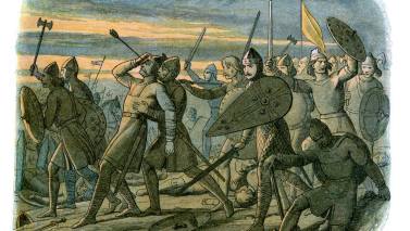
The delightfully named Ravenser Odd sat between the North Sea and the Humber, perched on a long promontory named ‘the Raven’s Tongue’ (Hrafn’s Eyr), and reached by a road ‘no broader than an arrow’s flight’. A little way from the original site of Ravenser – mentioned in Icelandic literature about the battle of Stamford Bridge – Ravenser Odd was built on sands and stone ‘cast up’ by the sea. By the 13th century it was a prosperous town, bustling with merchants and fishermen. By the end of the 14th, it was gone entirely. Storms eroded the sandbanks it stood on, until the great flood of 1362 finally destroyed it, sending it tumbling into the water. It would lie undisturbed for more than 650 years.
At the Sullom Voe inlet in the Shetland Islands, peat banks rise above the water. Cut open to the outside world, nine metres above the high tide mark, the dark soil gives way to a layer of light sand, marked by fragments of wood. Across the east coast of Scotland similar sand layers are found, reaching as far as 50 miles inland, and dating back thousands of years. It’s not uncommon for land to be made of ancient seabed; the badlands of Kansas are home to chalk pillars left behind when prehistoric seas retreated. But the sand on the Shetlands is different. It was left behind when sea levels were lower – when the soil was 20 metres above the coast. In other words, it was left behind by a gigantic wave.
In the Norwegian sea, at the edge of the continental shelf, a thousand mile scar is carved into the seabed; the remains of a tremendous underwater landslide. In 1931 fishermen in the North Sea dredged up a barbed harpoon, carved from the antler of a red deer. Fifty years later, radiocarbon dating produced our best guess at its origin: 11,000 BC. Dogger Bank is best known today through the nightly litany of the shipping forecast, sandwiched between Tyne and Fisher. Ten thousand years ago, it was forest and meadow populated by hunter gatherers, home to a lake where the Thames met with the Rhine to feed the Channel River. As the last ice age ended, rising sea levels began to drown the low-lying land, creating a chain of low-lying islands. The Storegga landslides, and the gigantic waves they created, spelled the end for any people left on them, and for many around the coast of Britain. The rising sea levels of this century are unlikely to be so dramatic as the drowning of Dunwich or flooding of Doggerland, scant consolation as that will be to those who lose their homes to the water.
But it is fascinating to think how these lost villages will feed into local tales centuries in the future. You can, if you want to, see glimpses of Britain’s long history in myths and stories. In Wales, storms in 2019 uncovered the petrified remains of a prehistoric forest buried under sand and water. People drew the link to the myth of a kingdom defended by complex sea walls, drowned when a drunkard neglected his duty and let the storm waters run in. No such kingdom existed, but give people glimpses of distant human inhabitation, and stories naturally grow. Similarly, old Manx myths talking of submerged islands cursed by Finn MacCool, or which claim that the sandbanks which stranded King William used to be part of the island until ‘a furious wind’ tore them away, are exactly the sort of thing you might dream up watching the waves erode the coast. That the Island was, thousands of years ago, much larger – connected by a land bridge to Cumbria – is just an added bonus.


Comments