Long life | 3 September 2015
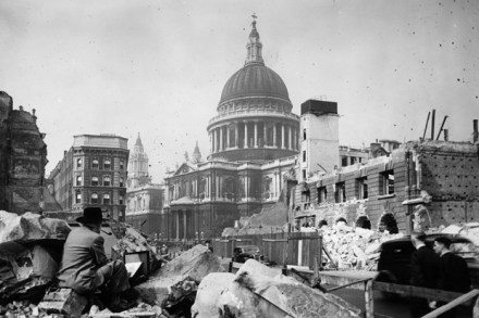
While the Germans were raining bombs on London during the second world war, the architects’ department of London County Council was busy colouring in Ordnance Survey maps of the city to record which buildings had been destroyed and which had not. These maps have now been published as a book by Thames and Hudson, The London County Council Bomb Damage Maps, 1939-45. Those buildings that had been totally destroyed were coloured black on the maps; those that had been damaged beyond repair, purple. And a review of this book in last Saturday’s edition of the Times was accompanied by a reproduction of one map covering the area around St Paul’s